Ruta 40 Gas Stations: Southern Patagonia Fuel Map
Complete guide to gas stations along Argentina's legendary Ruta 40 in southern Patagonia. Station locations, distances, fuel types, and survival tips for the most remote highway.
Argentina's Ruta Nacional 40 is one of the world's great road trips - and one of its most challenging for fuel planning. Stretching over 5,000 km from the Bolivian border to Río Gallegos, the southern Patagonia section features vast distances between tiny towns and gas stations that may or may not be open.
This guide covers: El Calafate to Río Gallegos (the most-traveled southern section)
Key facts:
- Total distance: ~650 km (El Calafate → Río Gallegos)
- Gas stations: 6-8 along the route
- Longest gap without fuel: ~210 km
- Road surface: Mix of paved and gravel (ripio)
El Calafate (Starting Point)
El Calafate is the gateway to Los Glaciares National Park and has the best fuel infrastructure in southern Patagonia.
| Station | Location | Hours | Payment | Notes |
|---|---|---|---|---|
| YPF Centro | Av. Libertador | 6 AM - 11 PM | Cards + Cash | Most reliable |
| Shell | Av. Libertador 1302 | 24 hours | Cards + Cash | Best for late arrivals |
| Axion | Route 11/40 junction | 7 AM - 10 PM | Cards + Cash | Easy highway access |
Stock up here: El Calafate has the last reliable, full-service stations before long empty stretches.
El Chaltén (Detour from Ruta 40)
220 km northwest of El Calafate, El Chaltén has ONE gas station with significant limitations.
| Station | Payment | Hours | Notes |
|---|---|---|---|
| YPF El Chaltén | CASH ONLY | 8 AM - 8 PM | Long queues, can run out |
Warning: The El Chaltén YPF is notorious. See our detailed El Chaltén fuel guide.
Ruta 40 detour distance: 440 km round trip from El Calafate junction Fuel strategy: Fill in El Calafate, don't rely on El Chaltén
Tres Lagos
Small roadside town 150 km south of El Calafate on Ruta 40.
| Station | Type | Hours | Payment | Notes |
|---|---|---|---|---|
| YPF Tres Lagos | Small | Variable | Cash preferred | Unreliable hours |
Reality check:
- Station exists but may be closed
- Can run out of fuel (especially diesel)
- Limited quantities even when open
- Cash in pesos essential
Distance from El Calafate: ~150 km Distance to next fuel (Gobernador Gregores): ~210 km
Recommendation: Fill in El Calafate. Treat Tres Lagos as emergency backup only.
Gobernador Gregores
The largest town between El Calafate and the coast. Has more reliable fuel.
| Station | Location | Hours | Payment | Notes |
|---|---|---|---|---|
| YPF Gregores | Downtown | 7 AM - 10 PM | Cards + Cash | Most reliable |
| COPEC | Route 40 | 7 AM - 9 PM | Cash preferred | Smaller |
Distance from El Calafate: ~360 km Distance from Tres Lagos: ~210 km Distance to Río Gallegos: ~290 km
This is a critical fuel stop. Don't pass through without filling up.
San Julián
Coastal town east of Ruta 40, accessible via RP-25.
| Station | Hours | Payment | Notes |
|---|---|---|---|
| YPF San Julián | 7 AM - 10 PM | Cards + Cash | Good supply |
| Shell | 7 AM - 9 PM | Cards + Cash | Alternative |
Detour from Ruta 40: ~150 km each way via RP-25 Reason to detour: More reliable than some Ruta 40 stations
Puerto San Julián (Coastal Alternative)
If taking coastal Ruta 3 instead of Ruta 40:
Reliable stations. Multiple YPF and Shell stations, normal hours, cards accepted.
Piedra Buena / Comandante Luis Piedra Buena
Town on Ruta 3, south of where 40 joins the coast.
| Station | Hours | Payment | Notes |
|---|---|---|---|
| YPF Piedra Buena | 24 hours | Cards + Cash | Reliable |
| Axion | 6 AM - 11 PM | Cards + Cash | Good alternative |
Distance from Gobernador Gregores: ~180 km (via Ruta 3 junction) Distance to Río Gallegos: ~110 km
Río Gallegos
Capital of Santa Cruz province. Full urban fuel infrastructure.
| Station | Location | Hours | Payment |
|---|---|---|---|
| YPF Multiple | Throughout city | 24 hours available | Cards + Cash |
| Shell Multiple | Throughout city | 24 hours available | Cards + Cash |
| Axion Multiple | Throughout city | Varies | Cards + Cash |
Río Gallegos is your base for trips to:
- Punta Arenas, Chile (250 km)
- Ushuaia via Ruta 3 (600 km)
- Return north on Ruta 40
El Calafate to Río Gallegos (Direct)
| Segment | Distance | Road | Fuel | Cumulative |
|---|---|---|---|---|
| El Calafate | Start | Paved | Full service | 0 km |
| Calafate → Tres Lagos | 150 km | Paved | Unreliable | 150 km |
| Tres Lagos → Gobernador Gregores | 210 km | Mixed | Available | 360 km |
| Gregores → Piedra Buena | 180 km | Mostly paved | Available | 540 km |
| Piedra Buena → Río Gallegos | 110 km | Paved | Full service | 650 km |
Fuel Consumption Reality
Ruta 40's gravel sections significantly increase fuel consumption.
| Surface | Consumption (L/100km) | Tank Range (55L) |
|---|---|---|
| Smooth pavement | 9-10 | ~550 km |
| Rough pavement | 10-11 | ~500 km |
| Good ripio | 11-13 | ~420-450 km |
| Bad ripio | 13-16 | ~350-400 km |
| Headwinds (common) | +10-15% | Reduces range |
Can You Make It?
El Calafate to Gobernador Gregores (360 km, worst stretch):
| Tank Size | Scenario | Result |
|---|---|---|
| 55L | All paved at 10 L/100km | 550 km range ✓ |
| 55L | 50% ripio at 12 L/100km | 458 km range ✓ |
| 55L | Heavy ripio + wind at 15 L/100km | 367 km range ⚠️ |
| 45L | 50% ripio at 12 L/100km | 375 km range ⚠️ |
Bottom line: Most vehicles with 55L+ tanks can make it, but margins are tight in bad conditions.
As of 2024, Ruta 40 in Patagonia is increasingly paved, but unpaved sections remain.
Current Status (South Section)
| Segment | Surface | Notes |
|---|---|---|
| El Calafate → Tres Lagos | Mostly paved | Some rough patches |
| Tres Lagos → Gregores | Mixed | Significant ripio sections |
| Gregores → Ruta 3 junction | Mostly paved | Good condition |
| Ruta 3 to Río Gallegos | Paved | Excellent condition |
Ripio Driving Tips
- Slow down: 60-80 km/h max on gravel
- Avoid corrugations: They shake fuel from tanks
- Reduce tire pressure: Some recommend 28-30 PSI for ripio
- Watch for "huella": Follow existing tire tracks
- Drive smoothly: Aggressive acceleration wastes fuel
Patagonian Wind
The wind is legendary and affects fuel consumption significantly.
| Wind Condition | Consumption Impact | Practical Effect |
|---|---|---|
| Calm | Baseline | Normal range |
| Moderate | +10-15% | Noticeable |
| Strong | +20-30% | Significant |
| Extreme | +30-50% | Consider stopping |
Wind direction matters:
- Westerly headwinds (most common): Highest impact
- Tailwinds: Actually improve efficiency
- Crosswinds: Force steering corrections, moderate impact
Seasonal Considerations
Summer (December-February):
- Longest days, most driving time
- Highest traffic (easier to get help)
- All stations theoretically open
- Still plan conservatively
Shoulder (March-April, October-November):
- Shorter days
- Less traffic
- Some small stations may have reduced hours
- Wind can be extreme
Winter (May-September):
- Short days limit driving
- Many ripio sections impassable
- Small stations may close entirely
- Only attempt with full preparations
What to Carry
| Currency | Amount | Purpose |
|---|---|---|
| Argentine pesos (ARS) | 150,000+ | Fuel at small stations |
| Chilean pesos (CLP) | 50,000+ | If crossing to Chile |
| USD cash | $100-200 | Emergency backup |
ATM Strategy
| Town | ATM Availability | Notes |
|---|---|---|
| El Calafate | Multiple | Best to stock up here |
| Tres Lagos | None | No banking |
| Gobernador Gregores | 1-2 ATMs | May have limits |
| Río Gallegos | Multiple | Full urban banking |
Critical: Withdraw enough cash in El Calafate to fuel your entire Ruta 40 journey.
If You Run Low
Priority fuel sources on Ruta 40:
- Next scheduled station (even if small)
- Estancias (ranches) - may sell from farm supply
- Other travelers (overlanders often carry extra)
- Commercial trucks
- Police/emergency services
Emergency Numbers
| Service | Number | Notes |
|---|---|---|
| Argentine Emergency | 107 | All emergencies |
| Police | 101 | General assistance |
| ACA (Auto Club) | 0800-888-9888 | Roadside assistance |
| Your rental company | Check contract | 24/7 line |
Towing Costs
Towing on Ruta 40 is expensive due to distances:
| Situation | Estimated Cost |
|---|---|
| Short tow (under 50 km) | $150-250 USD |
| Medium tow (50-100 km) | $250-400 USD |
| Long tow (100+ km) | $400-800+ USD |
Before Leaving El Calafate
- Full tank of fuel
- 150,000+ ARS in cash
- Offline maps downloaded
- Emergency numbers saved
- Vehicle tire pressure checked
- Spare tire verified
- Water and snacks for delays
- Warm clothes (weather changes fast)
- Know your vehicle's fuel consumption
At Each Station Stop
- Fill tank completely (don't gamble)
- Check tire pressure
- Confirm hours of next station
- Use restroom (next may be 200+ km)
- Buy water/snacks if available
Ruta 40 in southern Patagonia is an unforgettable drive through stunning emptiness. That emptiness includes a scarcity of gas stations.
Key rules:
- Fill completely in El Calafate - Last reliable fuel
- Never pass a station without topping up
- Carry plenty of cash - Cards often don't work
- Plan for ripio - It dramatically increases consumption
- Respect the wind - It's not a myth
The 650 km from El Calafate to Río Gallegos is manageable with planning. Without it, you're gambling with the Patagonian steppe.
- Vialidad Nacional Argentina - Official Ruta 40 road conditions
- YPF Argentina - YPF station network and locator
- ACA - Automóvil Club Argentino - Roadside assistance and road information
- Dirección Provincial de Vialidad Santa Cruz - Santa Cruz province road information
Ready for the adventure? Browse our rental vehicles suited for Ruta 40, with partners who understand these roads.
Frequently Asked Questions
What is the longest stretch without fuel on Ruta 40?
Between Gobernador Gregores and Tres Lagos, there are approximately 210 km with no guaranteed fuel. The Tres Lagos station is small and sometimes closed or empty.
Do Ruta 40 gas stations accept credit cards?
Larger towns (El Calafate, Río Gallegos) accept cards. Smaller stations (Tres Lagos, Perito Moreno) often require cash in Argentine pesos. Always carry cash.
Is Ruta 40 paved in Patagonia?
Large sections are now paved, but significant stretches remain unpaved (ripio). Gravel roads increase fuel consumption by 15-25%. Plan accordingly.
Image Generation Prompt
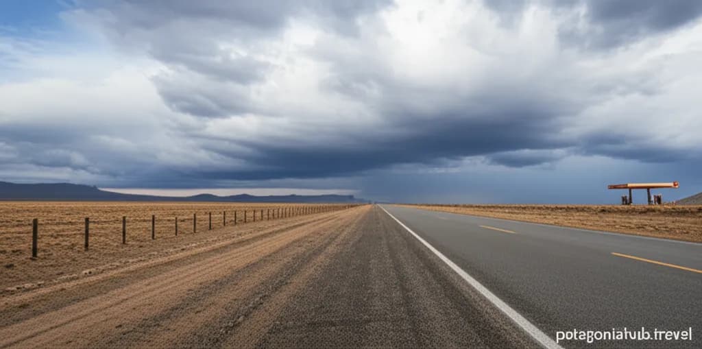
Create a focused photograph for a travel guide about gas stations on Ruta 40 in Patagonia. Show a lonely stretch of Ruta 40 highway through the vast Patagonian steppe with dramatic clouds and a distant gas station sign. Style: Professional travel photography, high quality, 16:9 aspect ratio. No watermarks. Include subtle 'patagoniahub.travel' branding in the bottom right corner.
Related Guides

El Chalten Gas Station: The Remote YPF You Need to Know
Everything about fueling up in El Chalten, Argentina. Learn about the single YPF station, payment issues, long queues, and why you should fill up in El Calafate first.

Fuel Prices in Patagonia: Chile vs Argentina Comparison
Compare fuel costs between Chile and Argentina in Patagonia. Understand price differences, payment methods, and strategies to save money on your road trip.

Complete Patagonia Gas Station Guide: Where to Fill Up
The essential fuel planning guide for Patagonia road trips. Find every gas station location, learn about fuel types, and avoid running empty in this remote region.